
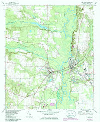
1971 Map of Montezuma
USGS Topo · Published 1974About this map
Montezuma and Oglethorpe anchor this central Georgia landscape where the Flint River separates the two towns. In the early 1970s, the area's geography was defined by a complex network of waterways, including Buck Creek and Whitewater Creek, which feeds into the prominent Whitewater State Park. The map reveals a community centered around its religious and educational institutions, with numerous country churches like Mt Zion Ch and Hephzibah Ch dotting the countryside.
Find a feature on this map
38 named features on this map. Tap any name to fly to it.
Don’t see what you’re looking for? This feature index may not catch every label — zoom into the map to look around manually.
Map Details
Editions of this 1971 Montezuma Map
2 editions found
Other maps of this area

1955 · Phenix City
USGS Topo · 1:250,000

1957 · Phenix City
USGS Topo · 1:250,000

1957 · Macon
USGS Topo · 1:250,000

1958 · Macon
USGS Topo · 1:250,000

1958 · Phenix City
USGS Topo · 1:250,000

1964 · Macon
USGS Topo · 1:250,000

1971 · Ideal South
USGS Topo · 1:24,000

1971 · Ideal North
USGS Topo · 1:24,000

1971 · Garden Valley
USGS Topo · 1:24,000

1972 · Byromville
USGS Topo · 1:24,000