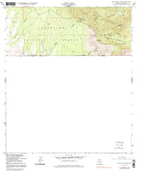
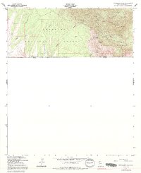
1958 Map of Montezuma Pass
USGS Topo · Published 1991About this map
Coronado National Memorial and the southern reaches of the Huachuca Mountains dominate this borderland survey, which documents the rugged transition between the United States and Mexico. The landscape is a complex network of resource extraction and high-altitude terrain, marked by the presence of the State of Texas Mine and Morgan Mine in the northern canyons. Transportation through the mountains is anchored at Montezuma Pass, while numerous water sources like Yaqui Spring, Eighty Spring, and Oak Spring suggest the critical importance of reliable water in this arid environment. Significant elevations at Coronado Peak and Montezuma Peak oversee a terrain deeply incised by Cave Canyon and Montezuma Canyon, illustrating the challenging topography faced by early miners and forest rangers within the Coronado National Forest.
Find a feature on this map
29 named features on this map. Tap any name to fly to it.
Don’t see what you’re looking for? This feature index may not catch every label — zoom into the map to look around manually.
Map Details
Editions of this 1958 Montezuma Pass Map
5 editions found
Other maps of this area

1914 · Hereford
USGS Topo · 1:125,000

1922 · Sunnyside
USGS Topo · 1:62,500

1932 · Stark
USGS Topo · 1:62,500

1938 · Sunnyside
USGS Topo · 1:62,500

1948 · Huachuca Peak
USGS Topo · 1:24,000

1948 · Miller Peak
USGS Topo · 1:24,000

1948 · Sunnyside SE
USGS Topo · 1:24,000
1948 · Sunnyside SW
USGS Topo · 1:24,000
1948 · Sunnyside
USGS Topo · 1:62,500
1952 · Nicksville
USGS Topo · 1:24,000