
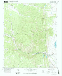
1961 Map of Montezuma
USGS Topo · Published 1965About this map
Gallinas Creek carves a critical path through the dramatic elevation changes of the The Creston and La Sierrita, serving as the primary corridor for settlement and water management in this 1961 survey. The village of Montezuma sits at the head of a managed water system that includes the Peterson Reservoir and the Intake Canal, which feeds into Storrie Lake to the east. This network reflects the transition from the high, canyon-riven terrain of Las Vegas to the irrigated agricultural lands on the lower plains.
Find a feature on this map
36 named features on this map. Tap any name to fly to it.
Don’t see what you’re looking for? This feature index may not catch every label — zoom into the map to look around manually.
Map Details
Editions of this 1961 Montezuma Map
2 editions found
Other maps of this area

1889 · Las Vegas
USGS Topo · 1:125,000

1891 · Las Vegas
USGS Topo · 1:125,000

1893 · Las Vegas
USGS Topo · 1:125,000

1954 · Santa Fe
USGS Topo · 1:250,000

1958 · Santa Fe
USGS Topo · 1:250,000

1961 · San Geronimo
USGS Topo · 1:24,000

1961 · El Porvenir
USGS Topo · 1:24,000
1961 · Ojitos Frios
USGS Topo · 1:24,000

1963 · Lake Isabel
USGS Topo · 1:24,000
1963 · Las Vegas
USGS Topo · 1:24,000