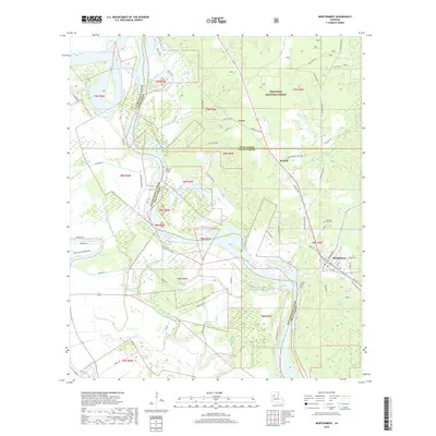
2018 Map of Montgomery
USGS Topo · Published 2018About this map
The Red River defines the western edge of this central Louisiana landscape, winding through a complex system of levees, bayous, and wetlands. Small settlements like Montgomery and Crews are connected by a network of local roads such as the Old Jefferson Hwy and Red River Levee Rd, while the eastern portion of the map transitions into the timbered reaches of the Kisatchie National Forest. The map documents a classic riverine environment where labels like Saint Maurice Lake, Quinn Brake, and Bayou des Glaizes indicate a terrain shaped by shifting watercourses.
Find a feature on this map
73 named features on this map. Tap any name to fly to it.
Don’t see what you’re looking for? This feature index may not catch every label — zoom into the map to look around manually.
Map Details
Editions of this 2018 Montgomery Map
This is the sole edition of this map. No revisions or reprints were ever made.
Other maps of this area

1935 · Verda
USGS Topo · 1:31,680

1937 · Bermuda
USGS Topo · 1:31,680

1937 · Campti SE
USGS Topo · 1:31,680

1937 · Aloha
USGS Topo · 1:31,680

1937 · Montgomery
USGS Topo · 1:62,500

1937 · Cloutierville
USGS Topo · 1:31,680

1937 · Cypress
USGS Topo · 1:31,680

1942 · Montgomery
USGS Topo · 1:62,500

1943 · Provencal
USGS Topo · 1:62,500

1944 · Campti
USGS Topo · 1:62,500