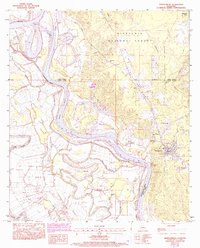
1983 Map of Montgomery
USGS Topo · Published 1993About this map
The Red River and Cane River Lake dominate this landscape on the border of Grant, Winn, and Natchitoches Parishes, where the river's shifting path has carved a complex network of bayous and backwaters. The town of Montgomery serves as a primary hub, flanked by the residential pockets of Pleasant Hill and Crews. Within the wooded reaches of the Kisatchie National Forest, the map documents a transition from bottomland waterways like Dunn Lake and Ben Lake to the upland terrain marked by New Salem Ch and Ebenezer Spring.
Find a feature on this map
42 named features on this map. Tap any name to fly to it.
Don’t see what you’re looking for? This feature index may not catch every label — zoom into the map to look around manually.
Map Details
Editions of this 1983 Montgomery Map
2 editions found
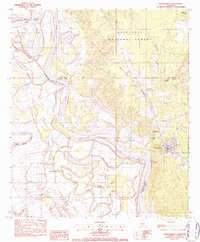
Other maps of this area

1935 · Verda
USGS Topo · 1:31,680

1937 · Bermuda
USGS Topo · 1:31,680

1937 · Campti SE
USGS Topo · 1:31,680

1937 · Aloha
USGS Topo · 1:31,680

1937 · Montgomery
USGS Topo · 1:62,500

1937 · Cloutierville
USGS Topo · 1:31,680

1937 · Cypress
USGS Topo · 1:31,680

1942 · Montgomery
USGS Topo · 1:62,500

1943 · Provencal
USGS Topo · 1:62,500

1944 · Campti
USGS Topo · 1:62,500