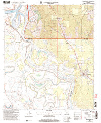
2003 Map of Montgomery
USGS Topo · Published 2005About this map
The Red River and Cane River Lake dominate this Louisiana landscape, framing a region defined by complex bayou systems and the timberlands of the Kisatchie National Forest. Near the confluence of Grant and Winn Parishes, the settlement of Montgomery serves as a local hub, supported by a network of rural institutions including Mt Vernon Ch and Pleasant Hill Sch. The terrain is deeply hydrological, featuring names like St Maurice Lake, Quinn Brake, and Bayou des Glaizes that reflect the traditional bottomland character of the Red River valley. Genealogists may find interest in the proximity of local landmarks like the Turk Az Cem and the small community of Crews, located just north of the parish boundary near New Salem Ch. The presence of the Robinson Landing Strip and various gravel pits suggests a mix of traditional agriculture and localized industry.
Find a feature on this map
42 named features on this map. Tap any name to fly to it.
Don’t see what you’re looking for? This feature index may not catch every label — zoom into the map to look around manually.
Map Details
Editions of this 2003 Montgomery Map
This is the sole edition of this map. No revisions or reprints were ever made.
Other maps of this area

1935 · Verda
USGS Topo · 1:31,680

1937 · Bermuda
USGS Topo · 1:31,680

1937 · Campti SE
USGS Topo · 1:31,680

1937 · Aloha
USGS Topo · 1:31,680

1937 · Montgomery
USGS Topo · 1:62,500

1937 · Cloutierville
USGS Topo · 1:31,680

1937 · Cypress
USGS Topo · 1:31,680

1942 · Montgomery
USGS Topo · 1:62,500

1943 · Provencal
USGS Topo · 1:62,500

1944 · Campti
USGS Topo · 1:62,500