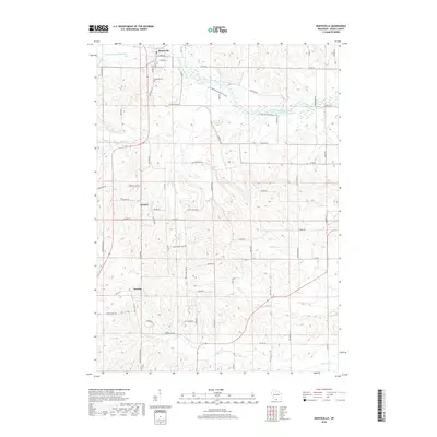
2018 Map of Monticello
USGS Topo · Published 2018About this map
The village of Monticello anchors this part of Green County, situated at the confluence where the W Br Little Sugar River joins the main Little Sugar River. The landscape is defined by the dendritic drainage patterns of numerous named creeks and branches, including Burgy Cr and Hammerly Cr, which carve through the undulating terrain near Autumn Ridge. This 2018 survey reveals a rural fabric maintained by a network of established county highways and local roads that connect the primary village to smaller outlying areas such as Schultz and Stearns.
Find a feature on this map
70 named features on this map. Tap any name to fly to it.
Don’t see what you’re looking for? This feature index may not catch every label — zoom into the map to look around manually.
Map Details
Editions of this 2018 Monticello Map
This is the sole edition of this map. No revisions or reprints were ever made.
Other maps of this area

1889 · Evansville
USGS Topo · 1:62,500

1893 · Brodhead
USGS Topo · 1:62,500

1894 · Evansville
USGS Topo · 1:62,500

1906 · Evansville
USGS Topo · 1:62,500

1920 · Monroe
USGS Topo · 1:62,500

1922 · Monroe
USGS Topo · 1:62,500

1923 · New Glarus
USGS Topo · 1:62,500

1954 · Rockford
USGS Topo · 1:250,000

1955 · Rockford
USGS Topo · 1:250,000

1958 · Rockford
USGS Topo · 1:250,000