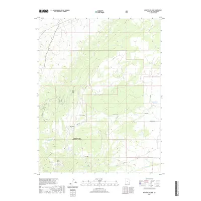
2020 Map of Monticello Lake
USGS Topo · Published 2020About this map
Manti-La Sal National Forest dominates this section of San Juan County, showcasing a high-altitude landscape defined by the Abajo Mountains and the prominent North Peak. The area's water management is evident through a series of reservoirs and natural catchments, including Monticello Lake, Gordon Reservoir, and Upper Bailey Reservoir, which reflect the region's reliance on mountain runoff. This upland terrain is deeply incised by drainages such as Big Canyon and Peters Canyon, while unique features like Prairie Dog Knoll provide distinct markers for local navigation.
Find a feature on this map
25 named features on this map. Tap any name to fly to it.
Don’t see what you’re looking for? This feature index may not catch every label — zoom into the map to look around manually.
Map Details
Editions of this 2020 Monticello Lake Map
This is the sole edition of this map. No revisions or reprints were ever made.
Other maps of this area

1885 · La Sal
USGS Topo · 1:250,000

1886 · Abajo
USGS Topo · 1:250,000

1892 · Abajo
USGS Topo · 1:250,000

1893 · Abajo
USGS Topo · 1:250,000

1935 · Elk Ridge
USGS Topo · 1:96,000

1940 · Elk Ridge
USGS Topo · 1:125,000

1954 · Elk Ridge 1 NE
USGS Topo · 1:24,000

1954 · Elk Ridge 1 SE
USGS Topo · 1:24,000

1954 · Mt Peale 3 SW
USGS Topo · 1:24,000

1954 · Mt Peale 3 SE
USGS Topo · 1:24,000