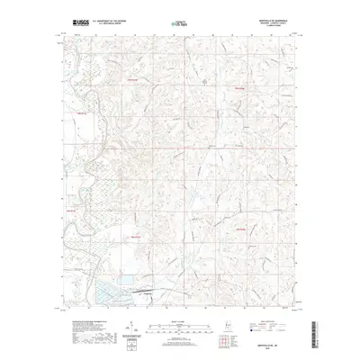
2020 Map of Monticello NE
USGS Topo · Published 2020About this map
The Ferguson settlement sits at the southern edge of this Lawrence County landscape, where the Pearl River winds through a valley defined by numerous small tributaries. The terrain is marked by a high density of rural cemeteries, including the North Pleasant Hill Cem, Stringer Cem, and Scarber Cem, which serve as vital landmarks for local family history research. North of the river, the geography is carved by Hurricane Cr and Price Cr, while the northwest corner features Cammack-Young Lake near the banks of Bahala Creek.
Find a feature on this map
74 named features on this map. Tap any name to fly to it.
Don’t see what you’re looking for? This feature index may not catch every label — zoom into the map to look around manually.
Map Details
Editions of this 2020 Monticello NE Map
This is the sole edition of this map. No revisions or reprints were ever made.
Other maps of this area

1953 · Hattiesburg
USGS Topo · 1:250,000

1953 · Natchez
USGS Topo · 1:250,000

1956 · Natchez
USGS Topo · 1:250,000

1958 · Hattiesburg
USGS Topo · 1:250,000

1959 · Natchez
USGS Topo · 1:250,000

1970 · Prentiss West
USGS Topo · 1:24,000

1970 · Monticello
USGS Topo · 1:24,000

1970 · New Hebron
USGS Topo · 1:24,000

1970 · Nola
USGS Topo · 1:24,000

1971 · Schley
USGS Topo · 1:24,000