
1953 Map of Natchez
USGS Topo · Published 1966About this map
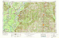
The Mississippi River dominates this mid-century landscape, carving a complex path of oxbow lakes and meanders between Natchez and Vidalia. The map illustrates the hydrological character of the river valley, where numerous water bodies like Lake Saint John, Lake Concordia, and Larto Lake reveal the river's historical shifts. To the east, the terrain transitions into the heavily forested uplands of the Homochitto National Forest, contrasting with the alluvial wetlands of the west. Civil infrastructure is well-defined by the reach of the Illinois Central RR and major junctions at Brookhaven and McComb. Smaller communities such as Gloster, Centreville, and Ferriday anchor the rural landscape, while the southern reaches feature the extensive Pomme de Terre Swamp, indicating the low-lying, water-logged nature of the Delta and border parishes during this era.
Find a feature on this map
66 named features on this map. Tap any name to fly to it.
Don’t see what you’re looking for? This feature index may not catch every label — zoom into the map to look around manually.
Map Details
Editions of this 1953 Natchez Map
Other maps of this area

1903 · Jackson
USGS Topo · 1:125,000

1906 · Bayou Sara
USGS Topo · 1:125,000

1906 · Florence
USGS Topo · 1:62,500

1908 · Florence
USGS Topo · 1:62,500

1909 · Delta Bridge
USGS Topo · 1:24,000

1909 · Sycamore Landing
USGS Topo · 1:24,000

1909 · Lake Bruen
USGS Topo · 1:24,000

1909 · Vidalia
USGS Topo · 1:24,000

1921 · Natchez
USGS Topo · 1:48,000

1922 · Natchez
USGS Topo · 1:62,500