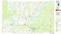
1984 Map of Natchez
USGS Topo · Published 1984About this map
The Mississippi River creates a meandering border between Mississippi and Louisiana, defining the landscape and settlement patterns of this 1984 survey. In Mississippi, Natchez stands as a prominent cultural hub, characterized by historic landmarks like the Natchez National Cemetery and the Natchez Post Office. The area is a nexus of rail transport, where the Illinois Central Gulf RR and Mississippi Central RR converge. To the north, the campus of Alcorn State University marks a significant educational footprint in the region.
Find a feature on this map
137 named features on this map. Tap any name to fly to it.
Don’t see what you’re looking for? This feature index may not catch every label — zoom into the map to look around manually.
Map Details
Editions of this 1984 Natchez Map
This is the sole edition of this map. No revisions or reprints were ever made.
Other maps of this area

1909 · Delta Bridge
USGS Topo · 1:24,000

1909 · Sycamore Landing
USGS Topo · 1:24,000

1909 · Lake Bruen
USGS Topo · 1:24,000

1909 · Vidalia
USGS Topo · 1:24,000

1921 · Natchez
USGS Topo · 1:48,000

1922 · Natchez
USGS Topo · 1:62,500

1935 · Winnsboro
USGS Topo · 1:62,500

1935 · Tooleys
USGS Topo · 1:62,500

1935 · Shackleford Lake
USGS Topo · 1:62,500

1939 · Red Gum
USGS Topo · 1:62,500