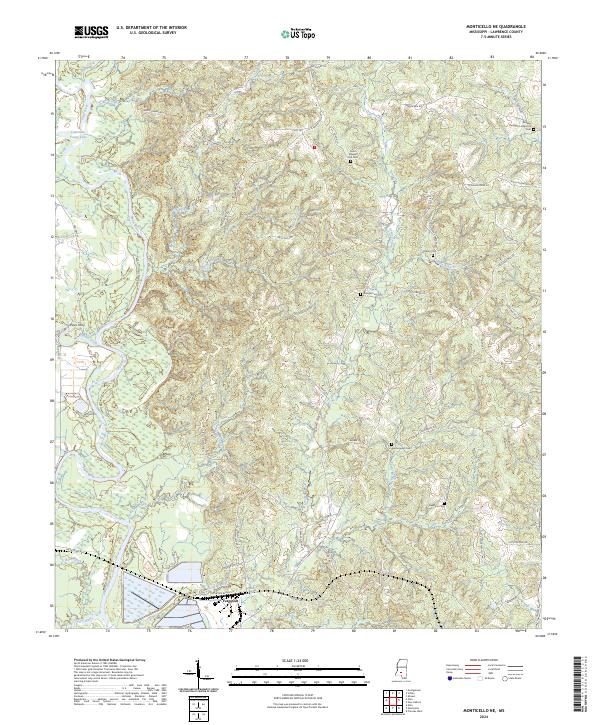
2024 Map of Monticello NE
USGS Topo · Published 2024About this map
Ferguson and Pines Ferry occupy the lowlands along the winding Pearl River in this part of Lawrence County. The landscape is defined by its intricate drainage system, where Crooked Creek and Hurricane Creek feed into the river basin near Young Lake. This 2024 data captures a rural territory still shaped by legacy road networks and family-named landmarks. Numerous small burial grounds are scattered across the terrain, including the Buckley Thompson Historical Cem and North Pleasant Hill Cem, serving as vital anchors for genealogical research in the region. The map illustrates a contemporary view of traditional Mississippi timberland and river bottom topography, showing how the local road system, including Sills Ferry Rd and Old Hwy 27, continues to follow the natural contours of the land and ancient river crossings.
Find a feature on this map
75 named features on this map. Tap any name to fly to it.
Don’t see what you’re looking for? This feature index may not catch every label — zoom into the map to look around manually.
Map Details
Editions of this 2024 Monticello NE Map
This is the sole edition of this map. No revisions or reprints were ever made.
Other maps of this area

1953 · Hattiesburg
USGS Topo · 1:250,000

1953 · Natchez
USGS Topo · 1:250,000

1956 · Natchez
USGS Topo · 1:250,000

1958 · Hattiesburg
USGS Topo · 1:250,000

1959 · Natchez
USGS Topo · 1:250,000

1970 · Prentiss West
USGS Topo · 1:24,000

1970 · Monticello
USGS Topo · 1:24,000

1970 · New Hebron
USGS Topo · 1:24,000

1970 · Nola
USGS Topo · 1:24,000

1971 · Schley
USGS Topo · 1:24,000