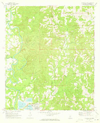
1971 Map of Monticello NE
USGS Topo · Published 1973About this map
The Pearl River snakes through the western portion of this Lawrence County landscape, defining a terrain of complex oxbows and wetlands including Sutton Lake and Cammack-Young Lake. Industry and infrastructure are concentrated in the south, where the Illinois Central railroad corridor supports a large Paper Mill complex, a dedicated reservoir, and a Pumping Station. This industrial footprint contrasts with the surrounding rural character, marked by numerous small cemeteries and timbered hills.
Find a feature on this map
41 named features on this map. Tap any name to fly to it.
Don’t see what you’re looking for? This feature index may not catch every label — zoom into the map to look around manually.
Map Details
Editions of this 1971 Monticello NE Map
This is the sole edition of this map. No revisions or reprints were ever made.
Other maps of this area

1953 · Hattiesburg
USGS Topo · 1:250,000

1953 · Natchez
USGS Topo · 1:250,000

1956 · Natchez
USGS Topo · 1:250,000

1958 · Hattiesburg
USGS Topo · 1:250,000

1959 · Natchez
USGS Topo · 1:250,000

1970 · Prentiss West
USGS Topo · 1:24,000

1970 · Monticello
USGS Topo · 1:24,000

1970 · New Hebron
USGS Topo · 1:24,000

1970 · Nola
USGS Topo · 1:24,000

1971 · Schley
USGS Topo · 1:24,000