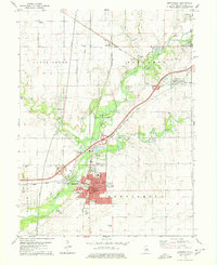
1979 Map of Monticello
USGS Topo · Published 1980About this map
Monticello serves as the focal point of this Piatt County landscape, situated where the Sangamon River begins its southward turn. This late 1970s record highlights a community well-served by rail infrastructure, with the Illinois Central Gulf, Norfolk and Western, and Illinois Terminal lines all converging or passing through the area. The presence of the Illinois Railway Museum near the river reflects this deep-rooted transportation heritage.
Find a feature on this map
48 named features on this map. Tap any name to fly to it.
Don’t see what you’re looking for? This feature index may not catch every label — zoom into the map to look around manually.
Map Details
Editions of this 1979 Monticello Map
This is the sole edition of this map. No revisions or reprints were ever made.
Other maps of this area

1907 · Mahomet
USGS Topo · 1:62,500

1937 · Monticello
USGS Topo · 1:48,000

1943 · Monticello
USGS Topo · 1:62,500

1950 · Tuscola
USGS Topo · 1:62,500

1955 · Bement
USGS Topo · 1:62,500

1957 · Mahomet
USGS Topo · 1:62,500

1958 · Peoria
USGS Topo · 1:250,000

1958 · Decatur
USGS Topo · 1:250,000

1961 · Peoria
USGS Topo · 1:250,000

1961 · Decatur
USGS Topo · 1:250,000