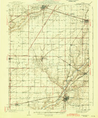
1943 Map of Monticello
USGS Topo · Published 1943About this map
The Sangamon River meanders through the southeastern portion of this Central Illinois landscape, anchoring a region defined by its intensive agricultural grid and dense network of rural schoolhouses. During the early 1940s, the area's social fabric was centered around small crossroads communities and family-named landmarks such as Campground Cem and Greenleaf Cem. The mapping reveals a high concentration of local education sites, including the Weedman Sch, Victory Sch, and Champion Sch, which served the scattered farming families in townships like Goose Creek and Willow Branch.
Find a feature on this map
86 named features on this map. Tap any name to fly to it.
Don’t see what you’re looking for? This feature index may not catch every label — zoom into the map to look around manually.
Map Details
Editions of this 1943 Monticello Map
2 editions found
Other maps of this area

1907 · Mahomet
USGS Topo · 1:62,500

1928 · Gibson City
USGS Topo · 1:62,500

1929 · Decatur
USGS Topo · 1:62,500

1933 · Decatur
USGS Topo · 1:62,500

1937 · Monticello
USGS Topo · 1:48,000

1943 · Monticello
USGS Topo · 1:62,500

1950 · Tuscola
USGS Topo · 1:62,500

1951 · Le Roy
USGS Topo · 1:62,500

1952 · Arrowsmith
USGS Topo · 1:62,500

1955 · Bement
USGS Topo · 1:62,500