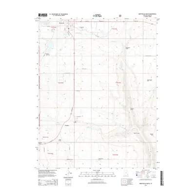
2014 Map of Monticello South
USGS Topo · Published 2014About this map
Monticello sits at the northern edge of this high-plateau landscape, where the town's southern expansion meets the agricultural and canyon lands of San Juan County. This 2014 survey captures a well-developed network of local roads such as S Highway 191 and E Highway 491 that link the town to the surrounding rural sections. Critical water infrastructure is prominent, including the Monticello City Number One Reservoir and Lloyds Lake, which serve this arid region's needs. To the south, the small settlement of Verdure marks a historical waypoint near Verdure Cr. The terrain transitions into dramatic relief at Montezuma Canyon and Boulder Canyon, while the western boundary is defined by the Manti-La Sal National Forest. Numerous named draws and hollows like Shingle Mill Draw and Bull Hollow suggest the intricate drainage patterns that have shaped local ranching and land use for generations.
Find a feature on this map
47 named features on this map. Tap any name to fly to it.
Don’t see what you’re looking for? This feature index may not catch every label — zoom into the map to look around manually.
Map Details
Editions of this 2014 Monticello South Map
This is the sole edition of this map. No revisions or reprints were ever made.
Other maps of this area

1886 · Abajo
USGS Topo · 1:250,000

1892 · Abajo
USGS Topo · 1:250,000

1893 · Abajo
USGS Topo · 1:250,000

1955 · Verdure 4 NW
USGS Topo · 1:24,000

1955 · Verdure 2 SE
USGS Topo · 1:24,000

1955 · Verdure 1 SW
USGS Topo · 1:24,000

1955 · Verdure 3 NE
USGS Topo · 1:24,000

1956 · Cortez
USGS Topo · 1:250,000

1957 · Monument Canyon
USGS Topo · 1:62,500

1957 · Blanding
USGS Topo · 1:62,500