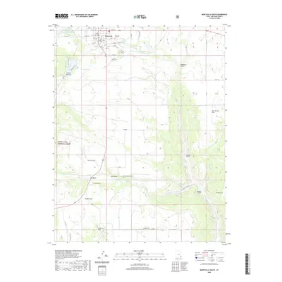
2020 Map of Monticello South
USGS Topo · Published 2020About this map
The San Juan County Court House serves as the focal point for this survey, which documents the transition from the municipal layout of Monticello into the dramatic drainages of the Colorado Plateau. The landscape is defined by deep incisions like Montezuma Canyon and Boulder Canyon, where ephemeral streams have carved complex paths through the high desert. To the west, the boundaries of the Manti-La Sal National Forest meet the edge of town, while water management features such as Lloyds Lake and the Monticello City Number One Reservoir highlight the critical role of irrigation in this arid environment. Genealogists will find the exact locations of the Monticello City Cem and the smaller Verdure Cem near the settlement of Verdure, documenting the resting places of the area's early residents along the historic transport corridors of the region.
Find a feature on this map
52 named features on this map. Tap any name to fly to it.
Don’t see what you’re looking for? This feature index may not catch every label — zoom into the map to look around manually.
Map Details
Editions of this 2020 Monticello South Map
This is the sole edition of this map. No revisions or reprints were ever made.
Other maps of this area

1886 · Abajo
USGS Topo · 1:250,000

1892 · Abajo
USGS Topo · 1:250,000

1893 · Abajo
USGS Topo · 1:250,000

1955 · Verdure 4 NW
USGS Topo · 1:24,000

1955 · Verdure 2 SE
USGS Topo · 1:24,000

1955 · Verdure 1 SW
USGS Topo · 1:24,000

1955 · Verdure 3 NE
USGS Topo · 1:24,000

1956 · Cortez
USGS Topo · 1:250,000

1957 · Monument Canyon
USGS Topo · 1:62,500

1957 · Blanding
USGS Topo · 1:62,500