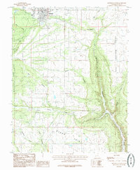
1985 Map of Monticello South
USGS Topo · Published 1985About this map
Monticello serves as the primary northern anchor of this landscape, situated just east of the Manti-La Sal National Forest boundary. The area transition from the town’s grid and its Golf Course to the deeply incised drainage systems of Montezuma Canyon and Boulder Canyon. To the south, the small settlement of Verdure sits along Verdure Creek, positioned at the crossroads of early regional travel and ranching.
Find a feature on this map
27 named features on this map. Tap any name to fly to it.
Don’t see what you’re looking for? This feature index may not catch every label — zoom into the map to look around manually.
Map Details
Editions of this 1985 Monticello South Map
This is the sole edition of this map. No revisions or reprints were ever made.
Other maps of this area

1886 · Abajo
USGS Topo · 1:250,000

1892 · Abajo
USGS Topo · 1:250,000

1893 · Abajo
USGS Topo · 1:250,000

1955 · Verdure 4 NW
USGS Topo · 1:24,000

1955 · Verdure 2 SE
USGS Topo · 1:24,000

1955 · Verdure 1 SW
USGS Topo · 1:24,000

1955 · Verdure 3 NE
USGS Topo · 1:24,000

1956 · Cortez
USGS Topo · 1:250,000

1957 · Monument Canyon
USGS Topo · 1:62,500

1957 · Blanding
USGS Topo · 1:62,500