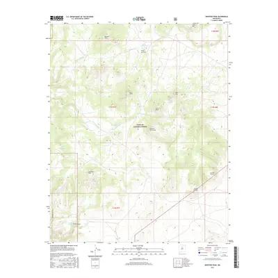
2017 Map of Montoso Peak
USGS Topo · Published 2017About this map
Santa Fe National Forest lands dominate this high-desert landscape in northern New Mexico, characterized by a complex network of volcanic peaks and arid drainage basins. The Caja del Rio Plateau serves as the central geographic feature, surrounded by prominent landmarks like Montoso Peak and Colorado Peak. Human impact in this dry environment is evidenced by a series of livestock water catchments including Tank Thirty-one, Tank Eighteen, and Tank Nineteen, which support grazing across the varied terrain. Significant erosion patterns are mapped through named drainages such as Arroyo Montoso and Arroyo Eighteen, which flow toward the deeper cut of Tetilla Canyon. The map also identifies local landmarks used for navigation and land management, such as Cerrito Pelado and the unusual geological depression at Tetilla Hole.
Find a feature on this map
26 named features on this map. Tap any name to fly to it.
Don’t see what you’re looking for? This feature index may not catch every label — zoom into the map to look around manually.
Map Details
Editions of this 2017 Montoso Peak Map
This is the sole edition of this map. No revisions or reprints were ever made.
Other maps of this area

1892 · Santa Clara
USGS Topo · 1:125,000

1951 · Agua Fria
USGS Topo · 1:24,000

1951 · Turquoise Hill
USGS Topo · 1:24,000

1952 · Turquoise Hill
USGS Topo · 1:24,000

1952 · White Rock
USGS Topo · 1:24,000

1952 · Frijoles
USGS Topo · 1:24,000

1952 · Montoso Peak
USGS Topo · 1:24,000

1953 · Cochiti Dam
USGS Topo · 1:24,000

1953 · Santo Domingo Pueblo
USGS Topo · 1:24,000

1953 · Horcado Ranch
USGS Topo · 1:24,000