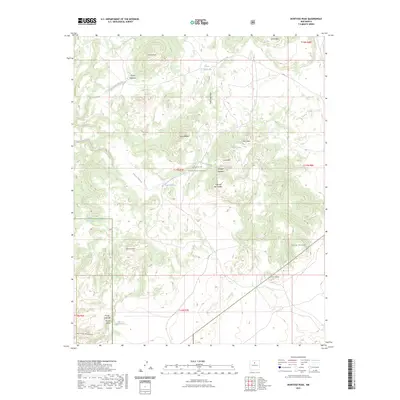
2023 Map of Montoso Peak
USGS Topo · Published 2023About this map
Santa Fe National Forest encompasses the high desert landscape of this Santa Fe County region, where the Caja del Rio Plateau meets a series of volcanic peaks and arroyos. The terrain is defined by prominent elevations such as Montoso Peak, Ortiz Mtn, and Cerro Micho, which rise above the surrounding tablelands. Water management in this arid environment is evidenced by features like Tank Thirty-one and Tank-Eighteen, alongside the natural drainage of Arroyo Montoso and Arroyo Eighteen. To the south, the landscape drops into the Tetilla Canyon, marked by the distinct Tetilla Hole and Arroyo Tetilla. This 2023 survey provides a clear view of the complex topography and ranching infrastructure, including landmarks like Cerrito Pelado and Cerrita Portillo that have long guided movement across these high plains.
Find a feature on this map
27 named features on this map. Tap any name to fly to it.
Don’t see what you’re looking for? This feature index may not catch every label — zoom into the map to look around manually.
Map Details
Editions of this 2023 Montoso Peak Map
This is the sole edition of this map. No revisions or reprints were ever made.
Other maps of this area

1892 · Santa Clara
USGS Topo · 1:125,000

1951 · Agua Fria
USGS Topo · 1:24,000

1951 · Turquoise Hill
USGS Topo · 1:24,000

1952 · Turquoise Hill
USGS Topo · 1:24,000

1952 · White Rock
USGS Topo · 1:24,000

1952 · Frijoles
USGS Topo · 1:24,000

1952 · Montoso Peak
USGS Topo · 1:24,000

1953 · Cochiti Dam
USGS Topo · 1:24,000

1953 · Santo Domingo Pueblo
USGS Topo · 1:24,000

1953 · Horcado Ranch
USGS Topo · 1:24,000