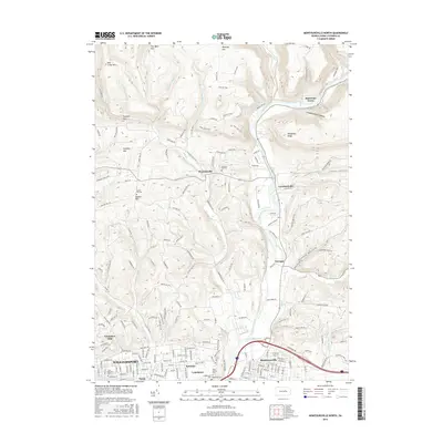
2016 Map of Montoursville North
USGS Topo · Published 2016About this map
Loyalsock Creek carves a path through the center of this landscape, anchoring a series of small valley communities such as Warrensville, Loyalsockville, and Farragut. To the south, the suburban edges of Williamsport begin to climb into the Grampian Hills, where neighborhoods like Faxon, Kenmar, and Lymehurst meet the more wooded uplands. The terrain is defined by high ridges including Blessing Mtn, Mill Creek Mtn, and the Allegheny Ridge, which rise above hollows like Crooked Riffles Hollow. This 2016 survey provides a record of family history sites across the countryside, marking several burial grounds such as Quaker Hill Cem, Christian Hill Cem, and Edgewood Cem. The transition from the developed Montoursville area to the steep, creek-fed valleys illustrates the geographic constraints that have shaped the growth of Lycoming County.
Find a feature on this map
193 named features on this map. Tap any name to fly to it.
Don’t see what you’re looking for? This feature index may not catch every label — zoom into the map to look around manually.
Map Details
Editions of this 2016 Montoursville North Map
This is the sole edition of this map. No revisions or reprints were ever made.
Other maps of this area

1921 · Williamsport
USGS Topo · 1:48,000

1921 · Trout Run
USGS Topo · 1:62,500

1923 · Trout Run
USGS Topo · 1:62,500

1923 · Williamsport
USGS Topo · 1:62,500

1924 · Milton
USGS Topo · 1:62,500

1930 · Warrensville
USGS Topo · 1:62,500

1934 · Warrensville
USGS Topo · 1:62,500

1944 · Trout Run
USGS Topo · 1:62,500

1944 · Williamsport
USGS Topo · 1:62,500

1953 · Warrensville
USGS Topo · 1:62,500
Featured Places
- Williamsport, PA
- Faxon, Loyalsock Township
- Penn Vale, Loyalsock Township
- Butternut Grove, Gamble Township
- Warrensville, Eldred Township