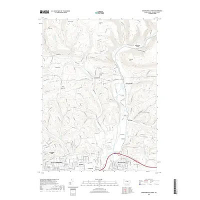
2019 Map of Montoursville North
USGS Topo · Published 2019About this map
Loyalsock Creek winds through this landscape north of the Susquehanna River, carving a valley between the prominent peaks of Mill Creek Mtn and Blessing Mtn. The area is characterized by a network of smaller rural settlements such as Warrensville, Loyalsockville, and Farragut, which are connected by a web of mountain roads and hollows. The northern reaches of Williamsport and Montoursville appear at the southern edge, showing the transition from urban neighborhoods like Faxon and Kenmar into the steep, wooded terrain of the Allegheny Ridge. Genealogists will find a high density of burial sites including the Oak Lawn and Christian Hill Cem and several private locations like the Scott Family Graveyard. This map details the local hydrology of Mill Creek and Lick Run as they descend from the highlands toward the developed valleys below.
Find a feature on this map
71 named features on this map. Tap any name to fly to it.
Don’t see what you’re looking for? This feature index may not catch every label — zoom into the map to look around manually.
Map Details
Editions of this 2019 Montoursville North Map
This is the sole edition of this map. No revisions or reprints were ever made.
Other maps of this area

1921 · Williamsport
USGS Topo · 1:48,000

1921 · Trout Run
USGS Topo · 1:62,500

1923 · Trout Run
USGS Topo · 1:62,500

1923 · Williamsport
USGS Topo · 1:62,500

1924 · Milton
USGS Topo · 1:62,500

1930 · Warrensville
USGS Topo · 1:62,500

1934 · Warrensville
USGS Topo · 1:62,500

1944 · Trout Run
USGS Topo · 1:62,500

1944 · Williamsport
USGS Topo · 1:62,500

1953 · Warrensville
USGS Topo · 1:62,500
Featured Places
- Williamsport, PA
- Faxon, Loyalsock Township
- Penn Vale, Loyalsock Township
- Butternut Grove, Gamble Township
- Warrensville, Eldred Township