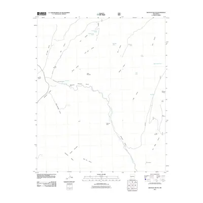
2011 Map of Montoya Butte
USGS Topo · Published 2011About this map
Alamosa Creek carves a significant path through this part of Socorro County, shaping a terrain defined by deep canyons and isolated water sources. The map highlights the Monticello Box and the winding Monticello Canyon, where the landscape transitions toward the Cuchillo Mountains in the south. This area is marked by its reliance on dispersed water infrastructure, with several tanks like Prairie Dog Tank and Bobtail Tank providing essential collection points in an arid environment. Historic ranching activity is evidenced by scattered landmarks such as Eds Windmill and the Upper Corral. Notable natural springs, including Ojo Caliente Spring and Alum Spring, offer unique points of interest for those studying the hydrology and settlement patterns of this New Mexico backcountry. The prominence of Montoya Butte serves as a major navigational landmark amidst the complex network of canyons like Wildhorse Canyon and San Mateo Canyon.
Find a feature on this map
38 named features on this map. Tap any name to fly to it.
Don’t see what you’re looking for? This feature index may not catch every label — zoom into the map to look around manually.
Map Details
Editions of this 2011 Montoya Butte Map
This is the sole edition of this map. No revisions or reprints were ever made.
Other maps of this area

1954 · Tularosa
USGS Topo · 1:250,000

1958 · Tularosa
USGS Topo · 1:250,000

1961 · Monticello
USGS Topo · 1:24,000

1964 · Welty Hill
USGS Topo · 1:24,000

1964 · Vicks Peak
USGS Topo · 1:24,000

1964 · Blue Mountain
USGS Topo · 1:24,000

1964 · Montoya Butte
USGS Topo · 1:24,000

1965 · Iron Mountain
USGS Topo · 1:24,000

1965 · Jaralosa Mountain
USGS Topo · 1:24,000

1965 · Dusty
USGS Topo · 1:24,000