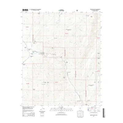
2013 Map of Montoya Butte
USGS Topo · Published 2013About this map
Montoya Butte rises as a central landmark in this high-desert reach of Socorro County, where the topography of the Cibola National Forest is defined by a dense network of canyons and arroyos. The drainage of Alamosa Cr carves a significant path through the landscape, creating the notable Monticello Box and winding past numerous springs like Ojo Caliente and Alum Spring. The map documents a land managed for water and grazing, evidenced by the distribution of stock tanks such as Prairie Dog Tank and Puppy Dog Tank, alongside rural infrastructure like Eds Windmill and Steel Windmill. To the southwest, the Sierra Cuchillo ridge defines the horizon, overlooking the intricate drainages of Mike Springs Canyon and Grapevine Canyon. This 2013 survey provides a clear view of the complex land divisions and the forest roads, including Forest Road 140, that provide access to this high-country terrain.
Find a feature on this map
47 named features on this map. Tap any name to fly to it.
Don’t see what you’re looking for? This feature index may not catch every label — zoom into the map to look around manually.
Map Details
Editions of this 2013 Montoya Butte Map
This is the sole edition of this map. No revisions or reprints were ever made.
Other maps of this area

1954 · Tularosa
USGS Topo · 1:250,000

1958 · Tularosa
USGS Topo · 1:250,000

1961 · Monticello
USGS Topo · 1:24,000

1964 · Welty Hill
USGS Topo · 1:24,000

1964 · Vicks Peak
USGS Topo · 1:24,000

1964 · Blue Mountain
USGS Topo · 1:24,000

1964 · Montoya Butte
USGS Topo · 1:24,000

1965 · Iron Mountain
USGS Topo · 1:24,000

1965 · Jaralosa Mountain
USGS Topo · 1:24,000

1965 · Dusty
USGS Topo · 1:24,000