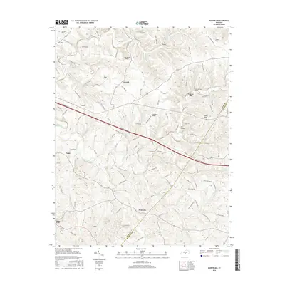
2016 Map of Montpelier
USGS Topo · Published 2016About this map
Montpelier and its surrounding countryside in Adair County are defined by a network of creeks and ridges that have shaped local movement for generations. To the north, Burton Ridge and Oak Grove Ridge overlook the valley of Sulphur Creek, while the southern reaches are drained by Russell Creek and its many tributaries like Big Clifty Creek and Cabin Fork Creek. The 2016 landscape preserves historical crossroads and small settlements such as Gentrys Mill, Ozark, and Glens Fork, which remain connected by winding local roads and the prominent corridor of the Cumberland Parkway. Genealogists may find value in the location of Wesley Cemetery near the southern border, while the placement of Tavern Spring and Wildcat Cave Hollow speaks to the natural landmarks and water sources that have long anchored this rural Kentucky community.
Find a feature on this map
125 named features on this map. Tap any name to fly to it.
Don’t see what you’re looking for? This feature index may not catch every label — zoom into the map to look around manually.
Map Details
Editions of this 2016 Montpelier Map
This is the sole edition of this map. No revisions or reprints were ever made.
Other maps of this area

1953 · Amandaville
USGS Topo · 1:24,000

1953 · Montpelier
USGS Topo · 1:24,000

1953 · Creelsboro
USGS Topo · 1:24,000

1953 · Jamestown
USGS Topo · 1:24,000

1953 · Dunnville
USGS Topo · 1:24,000

1953 · Cane Valley
USGS Topo · 1:24,000

1954 · Knifley
USGS Topo · 1:24,000

1954 · Columbia
USGS Topo · 1:24,000

1954 · Russell Springs
USGS Topo · 1:24,000

1956 · Corbin
USGS Topo · 1:250,000