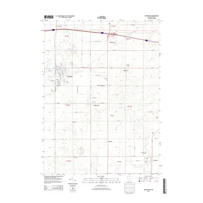
2013 Map of Montpelier
USGS Topo · Published 2013About this map
The Saint Joseph River winds through the northwestern corner of this landscape, framing the established town of Montpelier. This 2013 survey illustrates a transition from the dense street grid of the village, featuring thoroughfares like E Main St and Maplehurst Ave, to the more dispersed agricultural settlements of West Jefferson and Holiday City. The presence of numerous burial grounds, including Riverside Cem, Lick Creek Cem, and Shiffler Cem, provides significant geographic anchors for genealogists tracing family roots in this part of Williams County.
Find a feature on this map
67 named features on this map. Tap any name to fly to it.
Don’t see what you’re looking for? This feature index may not catch every label — zoom into the map to look around manually.
Map Details
Editions of this 2013 Montpelier Map
This is the sole edition of this map. No revisions or reprints were ever made.
Other maps of this area

1907 · Defiance
USGS Topo · 1:62,500

1909 · Defiance
USGS Topo · 1:62,500

1913 · Alvordton
USGS Topo · 1:62,500

1914 · Pioneer
USGS Topo · 1:62,500

1914 · Bryan
USGS Topo · 1:62,500

1943 · Bryan
USGS Topo · 1:62,500

1944 · Pioneer
USGS Topo · 1:62,500

1944 · Alvordton
USGS Topo · 1:62,500

1953 · Fort Wayne
USGS Topo · 1:250,000

1956 · Fort Wayne
USGS Topo · 1:250,000