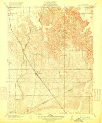
1916 Map of Montpellier
USGS Topo · Published 1916About this map
Montpellier and Hickman serve as the primary nodes of activity in this 1913 survey of the Central Valley transition into the Sierra foothills. The landscape is defined by the early engineering of the Turlock Irrigation Ditch, which cuts through the western plains to support local agriculture. The Southern Pacific railroad corridor establishes the region's commercial backbone, connecting these small settlements to wider markets. To the south and east, the map traces the Boundary Line separating Stanislaus Co and Merced Co, where the terrain begins to rise and undulate more sharply. This 1:31,680 scale survey, conducted under Chief Geographer R. B. Marshall, documents the precise layout of the Oakdale Branch and the sparse network of rural roads that linked these early ranching and farming communities at the height of the Progressive Era.
Find a feature on this map
7 named features on this map. Tap any name to fly to it.
Don’t see what you’re looking for? This feature index may not catch every label — zoom into the map to look around manually.
Map Details
Editions of this 1916 Montpellier Map
2 editions found
Other maps of this area

1913 · Dickenson
USGS Topo · 1:31,680

1915 · Paulsell
USGS Topo · 1:31,680

1916 · Three Tree Flat
USGS Topo · 1:31,680

1916 · Cressey
USGS Topo · 1:31,680

1916 · Montpellier
USGS Topo · 1:31,680

1916 · Cooperstown
USGS Topo · 1:31,680

1916 · Denair
USGS Topo · 1:31,680

1916 · Waterford
USGS Topo · 1:31,680

1917 · Turlock
USGS Topo · 1:31,680

1917 · Winton
USGS Topo · 1:31,680