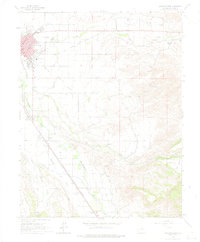
1962 Map of Montrose East
USGS Topo · Published 1975About this map
The Uncompahgre River corridor defines this landscape, where the eastern edge of Montrose meets the high ground of Kinikin Heights. During the early 1960s, the regional transportation network was anchored by the Denver and Rio Grande Western RR, which runs parallel to the river and several irrigation canals. Local community life is centered around institutions like St Marys Sch, Riverside Sch, and the Fairground, while the town's expansion is evidenced by the Drive-in Theater and the Radio Sta (KUBC) on the northern outskirts. Beyond the developed city grid, small settlements like Fairview and Vernal sit amidst a complex system of water management features, including the Filtration Plant and various named laterals. The map captures a transition from urban infrastructure to the agricultural and natural terrain of Arroyo and Dry Cedar Creek, providing a detailed look at land use before modern suburban growth.
Find a feature on this map
34 named features on this map. Tap any name to fly to it.
Don’t see what you’re looking for? This feature index may not catch every label — zoom into the map to look around manually.
Map Details
Editions of this 1962 Montrose East Map
4 editions found
Other maps of this area

1909 · Montrose
USGS Topo · 1:125,000

1911 · Montrose
USGS Topo · 1:125,000

1955 · Olathe
USGS Topo · 1:24,000

1955 · Red Rock Canyon
USGS Topo · 1:24,000

1956 · Montrose
USGS Topo · 1:250,000

1957 · Cerro Summit
USGS Topo · 1:24,000

1957 · Grizzly Ridge
USGS Topo · 1:24,000

1959 · Montrose
USGS Topo · 1:250,000

1960 · Montrose
USGS Topo · 1:250,000
1962 · Montrose East
USGS Topo · 1:24,000