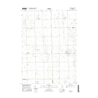
2017 Map of Montrose
USGS Topo · Published 2017About this map
The Flint River defines the eastern boundary of this mid-Michigan landscape, where the settlements of Montrose and Burt anchor a grid of agriculture and rural life. This area, spanning the borders of Saginaw, Genesee, and Shiawassee counties, is heavily shaped by its complex water management system. A dense network of man-made and natural waterways, including the Misteguay Cr, Montrose Drain, and Tupper Drain, crisscrosses the township lines to manage the level terrain. Local history is preserved in small clusters like Layton Corners and several denominational and community burial grounds. Genealogists may find interest in the proximity of Maple Grove Cem and Pine Grove Cem, alongside the Saint Michaels Cem and the Cooks Episcopal Cem located near the northern edge of the survey area.
Find a feature on this map
89 named features on this map. Tap any name to fly to it.
Don’t see what you’re looking for? This feature index may not catch every label — zoom into the map to look around manually.
Map Details
Editions of this 2017 Montrose Map
This is the sole edition of this map. No revisions or reprints were ever made.
Other maps of this area

1917 · Chesaning
USGS Topo · 1:62,500

1917 · St. Charles
USGS Topo · 1:62,500

1919 · Saginaw
USGS Topo · 1:62,500

1919 · Burt
USGS Topo · 1:62,500

1921 · Burt
USGS Topo · 1:62,500

1941 · Saginaw
USGS Topo · 1:62,500

1943 · Burt
USGS Topo · 1:62,500

1943 · Chesaning
USGS Topo · 1:62,500

1943 · Saginaw
USGS Topo · 1:62,500

1943 · St. Charles
USGS Topo · 1:62,500