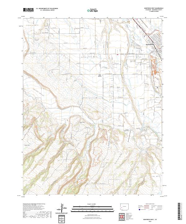
2022 Map of Montrose West
USGS Topo · Published 2022About this map
Montrose sits at the eastern edge of this landscape, where the modern street grid meets the high mesas and deep draws of the Uncompahgre Valley. The western expansion of the city is documented alongside the Colorado Mesa University Montrose Campus and the Montrose County Justice Center. Agricultural development is defined by an intricate network of waterways, including the Uncompahgre River, the Montrose and Delta Canal, and the C Canal, which feed the fertile stretches of Spring Creek Mesa and the Shavano Valley.
Find a feature on this map
93 named features on this map. Tap any name to fly to it.
Don’t see what you’re looking for? This feature index may not catch every label — zoom into the map to look around manually.
Map Details
Editions of this 2022 Montrose West Map
This is the sole edition of this map. No revisions or reprints were ever made.
Other maps of this area

1909 · Montrose
USGS Topo · 1:125,000

1911 · Montrose
USGS Topo · 1:125,000

1955 · Olathe
USGS Topo · 1:24,000

1955 · Red Rock Canyon
USGS Topo · 1:24,000

1956 · Montrose
USGS Topo · 1:250,000

1956 · Moab
USGS Topo · 1:250,000

1959 · Moab
USGS Topo · 1:250,000

1959 · Montrose
USGS Topo · 1:250,000

1960 · Montrose
USGS Topo · 1:250,000

1960 · Moab
USGS Topo · 1:250,000