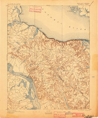
1895 Map of Montross
USGS Topo · Published 1901About this map
Montross and the surrounding Northern Neck peninsula are defined here by a dense network of tidal creeks and river landings at the turn of the century. The map illustrates a maritime economy dependent on the Potomac River and Rappahannock River, where numerous commercial hubs like Massey Wharf, Wirt Wharf, and Carter Wharf served as vital links for transporting agricultural goods and timber. The interior landscape is marked by small crossroads settlements such as Oak Grove, Baynesville, and Potomac Mills, connected by winding roads that follow the drainage divides between the Nomini Cliffs and the southern river valleys.
Find a feature on this map
58 named features on this map. Tap any name to fly to it.
Don’t see what you’re looking for? This feature index may not catch every label — zoom into the map to look around manually.
Map Details
Editions of this 1895 Montross Map
2 editions found

Other maps of this area

1889 · Fredericksburg
USGS Topo · 1:125,000

1892 · Leonardtown
USGS Topo · 1:62,500

1892 · Fredericksburg
USGS Topo · 1:125,000

1892 · Piney Point
USGS Topo · 1:62,500

1892 · Montross
USGS Topo · 1:62,500

1894 · Wicomico
USGS Topo · 1:62,500

1894 · Fredericksburg
USGS Topo · 1:125,000

1894 · Piney Point
USGS Topo · 1:62,500

1895 · Wicomico
USGS Topo · 1:62,500

1895 · Leonardtown
USGS Topo · 1:62,500