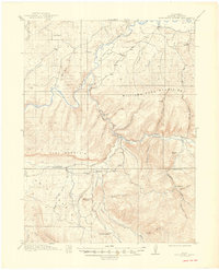
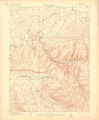
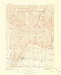
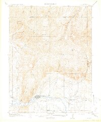
1915 Map of Monument Butte
USGS Topo · Published 1949About this map
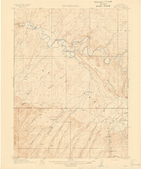
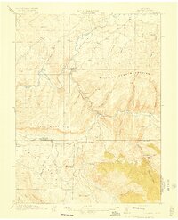
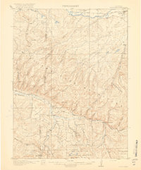
The Yampa River and Williams Fork dominate this 1912 survey of Northwest Colorado, where early ranching and coal mining operations defined the landscape. The confluence near Hamilton serves as a focal point, situated at the base of the Williams Fork Mountains. Settlement is sparse and focused on family holdings such as Iles Ranch, Durham Ranch, and Hart Ranch, reflecting the homesteading era of Moffat County. Transport through this high country relied on primary routes like the Craig and Meeker Road and the Pagoda and Deal Road. Evidence of early industrial activity appears at the Hart Mine, Hamilton Mine, and Walker Mine, while the presence of the Morapos School near the southern margin indicates the establishment of local community life amidst the ridges of Iles Mountain and the prominent Monument Butte.
Find a feature on this map
44 named features on this map. Tap any name to fly to it.
Don’t see what you’re looking for? This feature index may not catch every label — zoom into the map to look around manually.
Map Details
Editions of this 1915 Monument Butte Map
3 editions found
Other maps of this area

1910 · Danforth Hills
USGS Topo · 1:125,000
1912 · Meeker
USGS Topo · 1:62,500

1912 · Axial
USGS Topo · 1:62,500
1914 · Meeker
USGS Topo · 1:62,500
1914 · Axial
USGS Topo · 1:62,500
1915 · Monument Butte
USGS Topo · 1:62,500

1916 · Craig
USGS Topo · 1:125,000

1916 · Daton Peak
USGS Topo · 1:62,500
1920 · Daton Peak
USGS Topo · 1:62,500
1923 · Elkhead Creek
USGS Topo · 1:62,500