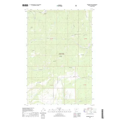
2020 Map of Monument Peak
USGS Topo · Published 2020About this map
Monument Peak rises as a prominent landmark within the Lewis & Clark National Forest, anchoring a high-altitude landscape defined by the Little Belt Mountains. This topography is marked by a series of named summits including Old Baldy, Sky Peak, and Mt Vesuvius, which overlook a complex drainage network. Water moves through the terrain via Tenderfoot Cr and its various tributaries, while smaller features like Daisy Spring provide critical water sources in the higher elevations. The map reveals a land structured by both its natural ridges, such as Rimrock Ridge, and the administrative boundaries of the national forest. Forest roads like Sheep Creek Rd provide the primary means of access through the deep valleys and parks, including Reynolds Park and Eagle Park, which break up the dense mountain terrain.
Find a feature on this map
39 named features on this map. Tap any name to fly to it.
Don’t see what you’re looking for? This feature index may not catch every label — zoom into the map to look around manually.
Map Details
Editions of this 2020 Monument Peak Map
This is the sole edition of this map. No revisions or reprints were ever made.
Other maps of this area

1886 · Great Falls
USGS Topo · 1:250,000

1886 · Fort Logan
USGS Topo · 1:250,000

1886 · Little Belt Mts.
USGS Topo · 1:250,000

1890 · Fort Benton
USGS Topo · 1:250,000

1892 · Fort Benton
USGS Topo · 1:250,000

1894 · Little Belt Mts.
USGS Topo · 1:250,000

1897 · Fort Benton
USGS Topo · 1:250,000

1897 · Little Belt Mts.
USGS Topo · 1:250,000

1898 · Little Belt Mts.
USGS Topo · 1:250,000

1902 · Little Belt Mts.
USGS Topo · 1:250,000