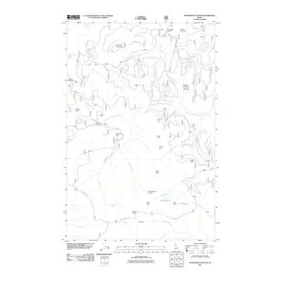
2011 Map of Monumental Buttes
USGS Topo · Published 2011About this map
Monumental Buttes rises as a prominent landmark in this high-elevation landscape of Shoshone County, characterized by its series of distinct summits including North Butte, South Butte, and East Butte. The Little North Fork Clearwater River winds through the central terrain, serving as the primary drainage for numerous creeks like Adair Creek and Meadow Creek. This 2011 survey captures the backcountry recreation infrastructure of the era, noting established sites such as the Twin Creek Campground and Little North Fork Campground. Small alpine water bodies, including Steamboat Lake and the aptly named Noseeum Lake, are situated among the peaks. The network of Forest Service roads, such as Adair Creek Rd and Buzzard Roost Rd, provides the only modern access through a landscape defined by significant peaks like Forage Mountain and Miller Peak.
Find a feature on this map
48 named features on this map. Tap any name to fly to it.
Don’t see what you’re looking for? This feature index may not catch every label — zoom into the map to look around manually.
Map Details
Editions of this 2011 Monumental Buttes Map
This is the sole edition of this map. No revisions or reprints were ever made.
Other maps of this area

1914 · Avery
USGS Topo · 1:125,000

1917 · Avery
USGS Topo · 1:125,000

1923 · Washington Creek
USGS Topo · 1:125,000

1936 · Boehls Butte
USGS Topo · 1:48,000

1943 · Boehls Butte
USGS Topo · 1:62,500

1956 · Wallace
USGS Topo · 1:250,000

1956 · Hamilton
USGS Topo · 1:250,000

1959 · Hamilton
USGS Topo · 1:250,000

1960 · Wallace
USGS Topo · 1:250,000

1960 · Hamilton
USGS Topo · 1:250,000