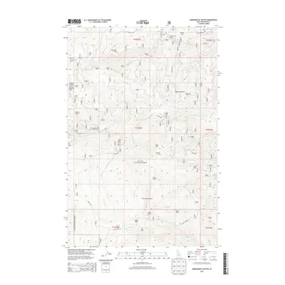
2013 Map of Monumental Buttes
USGS Topo · Published 2013About this map
St Joe National Forest dominates this mountain landscape, defined by a series of prominent peaks and high alpine meadows. The terrain is anchored by the Monumental Buttes, which rise above the surrounding drainage basins of the Little N Fork Clearwater River. High-altitude water bodies such as Steamboat Lake and the curiously named No-see-um Lake sit nestled among ridges including Miller Peak and South Butte. The map reflects a landscape primarily managed for conservation and recreation, evidenced by the Little North Fork Campground and Twin Creek Campground. Movement through this wilderness is restricted to specialized routes like Adair Creek Rd and Buzzard Roost Rd, connecting isolated points such as Fortynine Meadows and Spokane Meadows. This survey provides a precise view of the complex hydrology where Willow Cr and Rocky Run descend from the high divides.
Find a feature on this map
54 named features on this map. Tap any name to fly to it.
Don’t see what you’re looking for? This feature index may not catch every label — zoom into the map to look around manually.
Map Details
Editions of this 2013 Monumental Buttes Map
This is the sole edition of this map. No revisions or reprints were ever made.
Other maps of this area

1914 · Avery
USGS Topo · 1:125,000

1917 · Avery
USGS Topo · 1:125,000

1923 · Washington Creek
USGS Topo · 1:125,000

1936 · Boehls Butte
USGS Topo · 1:48,000

1943 · Boehls Butte
USGS Topo · 1:62,500

1956 · Wallace
USGS Topo · 1:250,000

1956 · Hamilton
USGS Topo · 1:250,000

1959 · Hamilton
USGS Topo · 1:250,000

1960 · Wallace
USGS Topo · 1:250,000

1960 · Hamilton
USGS Topo · 1:250,000