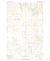
1970 Map of Moon Lake
USGS Topo · Published 1973About this map
Moon Lake and St Marys Lake dominate the northern landscape of this Barnes County territory, providing a central focus for the Moon Lake State Wildlife Management Area. The terrain is defined by the township divisions of Hemen, Green, Svea, and Skandia, where section lines and local roads cross a prairie environment dotted with small wetlands. A lone Townhall stands in the northwest, serving as a primary community landmark for the surrounding rural population.
Find a feature on this map
11 named features on this map. Tap any name to fly to it.
Don’t see what you’re looking for? This feature index may not catch every label — zoom into the map to look around manually.
Map Details
Editions of this 1970 Moon Lake Map
This is the sole edition of this map. No revisions or reprints were ever made.
Other maps of this area

1897 · Eckelson
USGS Topo · 1:125,000

1953 · Jamestown
USGS Topo · 1:250,000

1956 · Jamestown
USGS Topo · 1:250,000

1961 · Valley City West
USGS Topo · 1:24,000

1970 · Litchville
USGS Topo · 1:24,000
1970 · Hastings
USGS Topo · 1:24,000

1970 · Eckelson
USGS Topo · 1:24,000

1970 · Marion NE
USGS Topo · 1:24,000
1970 · Sanborn SE
USGS Topo · 1:24,000
1970 · Sanborn
USGS Topo · 1:24,000