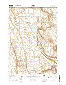
2017 Map of Moon Reservoir
USGS Topo · Published 2017About this map
Moon Reservoir serves as a central hydrological feature within the Silver Creek Valley, where the waters of Silver Creek are managed across a landscape defined by significant elevation changes. To the west, the Coyote Rim provides a prominent geological boundary, while the Battleground Buttes rise to the east, illustrating the complex volcanic and erosional history of this part of Harney County. The distribution of water resources is a primary theme of the map, showing numerous smaller basins and springs such as Antelope Reservoir, Grape Springs, and Homestead Hole. These features, alongside Quisenberry Lake and Horseshoe Reservoir, indicate a specialized land use pattern centered on seasonal water management and range resources in a high-desert environment. The remote character of the area is further evidenced by the sparse road network, including the specifically named Lone Rabb track.
Find a feature on this map
20 named features on this map. Tap any name to fly to it.
Don’t see what you’re looking for? This feature index may not catch every label — zoom into the map to look around manually.
Map Details
Editions of this 2017 Moon Reservoir Map
This is the sole edition of this map. No revisions or reprints were ever made.
Other maps of this area

1955 · Burns
USGS Topo · 1:250,000

1958 · Burns
USGS Topo · 1:250,000

1959 · Burns
USGS Topo · 1:250,000

1979 · Moon Reservoir
USGS Topo · 1:24,000

1980 · Capehart Lake
USGS Topo · 1:24,000

1980 · Iron Mtn. Flat
USGS Topo · 1:24,000

1980 · Stinking Lake
USGS Topo · 1:24,000

1980 · Lake on The Trail
USGS Topo · 1:24,000

1980 · Palomino Buttes
USGS Topo · 1:24,000

1981 · Sage Hen Hill
USGS Topo · 1:24,000