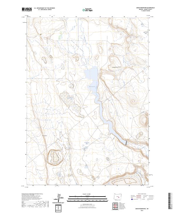
2024 Map of Moon Reservoir
USGS Topo · Published 2024About this map
Silver Creek Valley defines the drainage patterns of this high-desert landscape, where ephemeral water sources and carefully managed reservoirs dictate the rhythm of life in Harney County. The topography is dominated by distinct basaltic elevations, notably the Battleground Buttes and the sweeping arc of Coyote Rim. Between these heights, a network of named water features like Moon Reservoir, Dusenberry Lake, and Antelope Reservoir highlights the critical importance of water storage in this arid environment. The presence of Homestead Hole and Carvix Reservoir suggests specific points of human effort to harness the seasonal flow of Silver Creek for ranching and agriculture. Smaller, isolated basins such as Wild Horse Lake and Rock Lake sit at the northern edge of the survey, while Trap Springs provides a rare natural point of interest in the southern reaches of the quadrangle.
Find a feature on this map
20 named features on this map. Tap any name to fly to it.
Don’t see what you’re looking for? This feature index may not catch every label — zoom into the map to look around manually.
Map Details
Editions of this 2024 Moon Reservoir Map
This is the sole edition of this map. No revisions or reprints were ever made.
Other maps of this area

1955 · Burns
USGS Topo · 1:250,000

1958 · Burns
USGS Topo · 1:250,000

1959 · Burns
USGS Topo · 1:250,000

1979 · Moon Reservoir
USGS Topo · 1:24,000

1980 · Capehart Lake
USGS Topo · 1:24,000

1980 · Iron Mtn. Flat
USGS Topo · 1:24,000

1980 · Stinking Lake
USGS Topo · 1:24,000

1980 · Lake on The Trail
USGS Topo · 1:24,000

1980 · Palomino Buttes
USGS Topo · 1:24,000

1981 · Sage Hen Hill
USGS Topo · 1:24,000