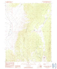
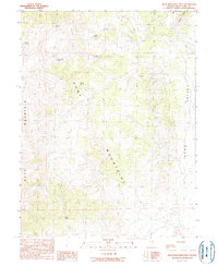
1990 Map of Mooney Basin Summit
USGS Topo · Published 1990About this map
The Ruby Mountains dominate this high-desert landscape in White Pine County, forming a rugged central spine between the open Newark Valley to the west and the expansive Mooney Basin to the east. By 1990, the region’s long mining history is represented by the industrial operations at the Alligator Ridge Gold Mine and numerous prospects scattered across the ridges. A significant historical corridor is preserved in the west, where the Route of Elko-Hamilton Stage Line skirts the mountain foothills, passing near the isolated Warm Springs Ranch. This survey captures a moment when modern gold extraction and ancient transport routes converged. The topography climbs from the basin floor up to the Mooney Basin Summit, while drainages like Martin Canyon and Orchard Can provide the only breaks in the arid terrain leading toward the high Alligator Ridge.
Find a feature on this map
14 named features on this map. Tap any name to fly to it.
Don’t see what you’re looking for? This feature index may not catch every label — zoom into the map to look around manually.
Map Details
Editions of this 1990 Mooney Basin Summit Map
This is the sole edition of this map. No revisions or reprints were ever made.
Other maps of this area

1956 · Ely
USGS Topo · 1:250,000

1957 · Buck Mountain
USGS Topo · 1:62,500

1957 · Cold Creek Ranch
USGS Topo · 1:62,500

1959 · Ely
USGS Topo · 1:250,000

1963 · Ely
USGS Topo · 1:250,000
1982 · Long Valley Slough
USGS Topo · 1:24,000
1982 · Tognini Spring
USGS Topo · 1:24,000
1982 · Sunshine Well NW
USGS Topo · 1:24,000

1985 · Newark Lake
USGS Topo · 1:100,000
1990 · Buck Mountain East
USGS Topo · 1:24,000