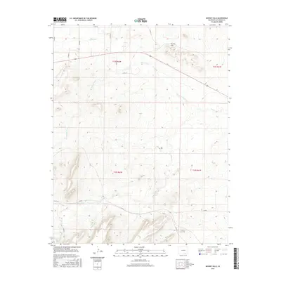
2016 Map of Mooney Hills
USGS Topo · Published 2016About this map
The Mooney Hills dominate the northeastern landscape of this Las Animas County terrain, where the high plains meet the intricate drainage systems of the Purgatoire River basin. Arroyos and creeks define the local geography, including the winding paths of Patton Arroyo, Frijole Cr, and El Poso Arroyo, which highlight the importance of water management in this arid environment. Evidence of human modification is visible in the S Side Ditch and a network of county roads such as Co RD 22 and Co RD 36 that connect the scattered ranches and land tracts of the Public Land Survey System. For family history researchers, the Vigil Cem stands as a significant cultural landmark, documenting the long-standing community presence in this section of Colorado. The map illustrates a rural landscape where natural features like San Miguel Cr and Capulin Arroyo intersect with a grid of property boundaries and livestock-raising infrastructure.
Find a feature on this map
25 named features on this map. Tap any name to fly to it.
Don’t see what you’re looking for? This feature index may not catch every label — zoom into the map to look around manually.
Map Details
Editions of this 2016 Mooney Hills Map
This is the sole edition of this map. No revisions or reprints were ever made.
Other maps of this area

1892 · Elmoro
USGS Topo · 1:125,000

1893 · Elmoro
USGS Topo · 1:125,000

1897 · Elmoro
USGS Topo · 1:125,000

1954 · Trinidad
USGS Topo · 1:250,000

1955 · Trinidad
USGS Topo · 1:250,000

1958 · Trinidad
USGS Topo · 1:250,000

1959 · Trinidad
USGS Topo · 1:250,000
1970 · Earl
USGS Topo · 1:24,000
1970 · Mooney Hills
USGS Topo · 1:24,000
1970 · Hoehne
USGS Topo · 1:24,000