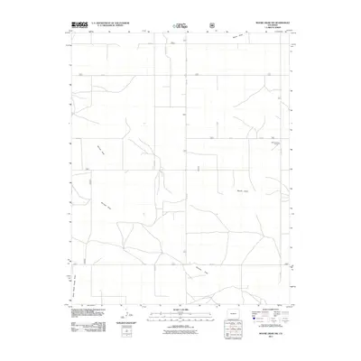
2011 Map of Moore Draw SW
USGS Topo · Published 2011About this map
Mount Carmel Cemetery stands as a quiet focal point in this high plains landscape of Baca County, marking a site of local genealogical importance. The terrain is defined by a series of intermittent watercourses, including Moore Draw and Murray Draw, which cut through the agricultural grid. This 2011 survey by the U.S. Geological Survey illustrates the intersection of natural drainage and human order, where rural routes like Co RD J and Co RD 36 follow the section lines regardless of the underlying topography. The drainage pattern of Burrows Draw and North Picker House Draw suggests a landscape shaped by seasonal water flow, typical of this portion of Colorado. For researchers, the map provides a precise layout of the county road network and its relation to the prominent local burial ground.
Find a feature on this map
11 named features on this map. Tap any name to fly to it.
Don’t see what you’re looking for? This feature index may not catch every label — zoom into the map to look around manually.
Map Details
Editions of this 2011 Moore Draw SW Map
This is the sole edition of this map. No revisions or reprints were ever made.
Other maps of this area

1891 · Springfield
USGS Topo · 1:125,000

1892 · Vilas
USGS Topo · 1:125,000

1893 · Springfield
USGS Topo · 1:125,000

1954 · Dalhart
USGS Topo · 1:250,000

1955 · La Junta
USGS Topo · 1:250,000

1958 · La Junta
USGS Topo · 1:250,000

1958 · Dalhart
USGS Topo · 1:250,000

1962 · Dalhart
USGS Topo · 1:250,000

1968 · La Junta
USGS Topo · 1:250,000
1969 · Razor Blade Mesa
USGS Topo · 1:24,000