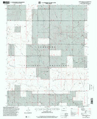
1996 Map of Moore Draw SW
USGS Topo · Published 2000About this map
Comanche National Grassland dominates this high plains landscape in Baca County, where complex drainage networks define the topography. The terrain is marked by numerous ephemeral watercourses, including the wide Moore Draw and Mitchell Draw in the north and the converging paths of Picket House Draw and Nevitt Draw to the south. These draws reveal the natural erosion patterns of the region's semi-arid environment during the mid-1990s.
Find a feature on this map
13 named features on this map. Tap any name to fly to it.
Don’t see what you’re looking for? This feature index may not catch every label — zoom into the map to look around manually.
Map Details
Editions of this 1996 Moore Draw SW Map
This is the sole edition of this map. No revisions or reprints were ever made.
Other maps of this area

1891 · Springfield
USGS Topo · 1:125,000

1892 · Vilas
USGS Topo · 1:125,000

1893 · Springfield
USGS Topo · 1:125,000

1954 · Dalhart
USGS Topo · 1:250,000

1955 · La Junta
USGS Topo · 1:250,000

1958 · La Junta
USGS Topo · 1:250,000

1958 · Dalhart
USGS Topo · 1:250,000

1962 · Dalhart
USGS Topo · 1:250,000

1968 · La Junta
USGS Topo · 1:250,000
1969 · Razor Blade Mesa
USGS Topo · 1:24,000