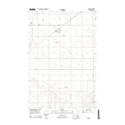
2014 Map of Moore
USGS Topo · Published 2014About this map
The settlement of Moore serves as the central hub for this portion of Fergus County, where the grid of the town site meets the diagonal transit corridor of Us-87. This area of the Judith Basin displays a landscape of high plains agriculture and drainage networks, with several watercourses like Dawkins Br and Olsen Cr carving through the terrain. To the west, Eddies Corner marks the intersection of major regional thoroughfares Us-87 and Us-191, a critical junction for travel in central Montana.
Find a feature on this map
33 named features on this map. Tap any name to fly to it.
Don’t see what you’re looking for? This feature index may not catch every label — zoom into the map to look around manually.
Map Details
Editions of this 2014 Moore Map
This is the sole edition of this map. No revisions or reprints were ever made.
Other maps of this area

1889 · Big Snowy Mountain
USGS Topo · 1:250,000

1893 · Big Snowy Mountain
USGS Topo · 1:250,000

1954 · Roundup
USGS Topo · 1:250,000

1954 · Lewistown
USGS Topo · 1:250,000

1958 · Roundup
USGS Topo · 1:250,000

1959 · Lewistown
USGS Topo · 1:250,000
1970 · Buffalo
USGS Topo · 1:24,000

1970 · Glengarry
USGS Topo · 1:24,000

1970 · Crystal Lake
USGS Topo · 1:24,000

1970 · Moore
USGS Topo · 1:24,000