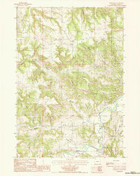
1984 Map of Moore Hill
USGS Topo · Published 1985About this map
Belle Fourche River winds through the southeastern corner of this Crook County landscape, defining the local drainage system alongside Whitetail Creek and Sourdough Creek. The terrain is characterized by a series of prominent ridges and drainages, most notably the Goldie Divide and the elevation of Moore Hill itself. Small-scale rural infrastructure is evident through the presence of multiple remote well sites, a Landing Strip, and several isolated Cem locations which hint at the region's dispersed settlement history.
Find a feature on this map
19 named features on this map. Tap any name to fly to it.
Don’t see what you’re looking for? This feature index may not catch every label — zoom into the map to look around manually.
Map Details
Editions of this 1984 Moore Hill Map
This is the sole edition of this map. No revisions or reprints were ever made.
Other maps of this area

1905 · Devils Tower
USGS Topo · 1:125,000

1954 · Strawberry Hill
USGS Topo · 1:24,000

1954 · Storm Hill
USGS Topo · 1:24,000

1954 · Missouri Buttes
USGS Topo · 1:24,000

1954 · Gillette
USGS Topo · 1:250,000

1955 · Devils Tower
USGS Topo · 1:62,500

1955 · Gillette
USGS Topo · 1:250,000

1957 · Oshoto
USGS Topo · 1:62,500

1957 · Seely
USGS Topo · 1:62,500

1957 · Cedar Ridge
USGS Topo · 1:62,500