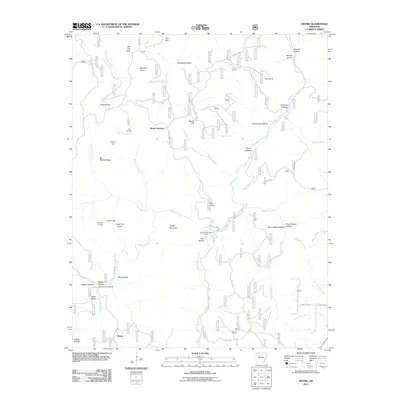
2011 Map of Moore
USGS Topo · Published 2011About this map
Richland Creek and its many tributaries, including Falling Water Creek and Long Devils Fork, define the drainage patterns of this upland terrain in the Ozarks. Small, isolated settlements like Moore, Iceledo, and Dickey Junction are connected by a network of winding county roads such as Searcy 12 Hwy and Ben Hur Cemetery Rd. The landscape is a complex system of named hollows and peaks, suggesting a history of subsistence living and specialized land use in areas like Cherry Flat and Big Middle Ridge. The presence of the Hill Cemetery and the Richland Recreation Area points to the dual nature of this region as both a place of deep-rooted family history and a modern destination for outdoor recreation. Numerous family-named landmarks like Blaylock Knob, Sutton Knob, and Meeks Hollow provide essential clues for genealogists tracing ancestral landholdings in Newton County.
Find a feature on this map
54 named features on this map. Tap any name to fly to it.
Don’t see what you’re looking for? This feature index may not catch every label — zoom into the map to look around manually.
Map Details
Editions of this 2011 Moore Map
This is the sole edition of this map. No revisions or reprints were ever made.
Other maps of this area

1879 · Washington
USGS Topo · 1:62,500

1887 · Smyrna
USGS Topo · 1:62,500

1889 · Treat
USGS Topo · 1:62,500

1889 · Marshall #3
USGS Topo · 1:62,500

1892 · Marshall
USGS Topo · 1:125,000

1894 · Marshall
USGS Topo · 1:125,000

1901 · Marshall
USGS Topo · 1:125,000

1932 · Treat
USGS Topo · 1:62,500

1933 · Mt Judea
USGS Topo · 1:62,500

1934 · Treat
USGS Topo · 1:62,500