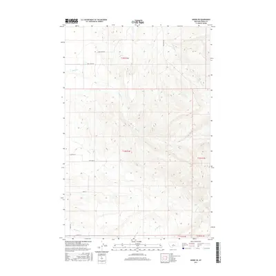
2017 Map of Moore SW
USGS Topo · Published 2017About this map
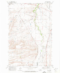
Buffalo Cr and its tributaries carve through the central landscape of Fergus County, defining the drainage patterns south of Moore during the mid-2010s. The terrain is marked by a network of rural routes that follow the natural topography, including Sheill Canyon Rd and the high ground along Logan Ridge Rd. These corridors connect remote ranchlands and homesteads, illustrating the enduring township and range system across sections of T12N R16E and T13N R16E. Lower-lying drainage ways such as Dry Creek and Meadow Creek are flanked by local markers like Larsen Ln and Barney Rd, which provide access to the interior of these cattle-country sections. The map reveals the relationship between water sources and the grid of access roads necessary for managing this stretch of the Montana plains.
Find a feature on this map
17 named features on this map. Tap any name to fly to it.
Don’t see what you’re looking for? This feature index may not catch every label — zoom into the map to look around manually.
Map Details
Editions of this 2017 Moore SW Map
This is the sole edition of this map. No revisions or reprints were ever made.
Other maps of this area

1889 · Big Snowy Mountain
USGS Topo · 1:250,000

1893 · Big Snowy Mountain
USGS Topo · 1:250,000

1954 · Roundup
USGS Topo · 1:250,000

1958 · Roundup
USGS Topo · 1:250,000
1970 · Buffalo
USGS Topo · 1:24,000

1970 · Crystal Lake
USGS Topo · 1:24,000

1970 · Moore
USGS Topo · 1:24,000
1970 · West Fork Beaver Creek
USGS Topo · 1:24,000
1970 · Moore SW
USGS Topo · 1:24,000
1970 · Sipple
USGS Topo · 1:24,000