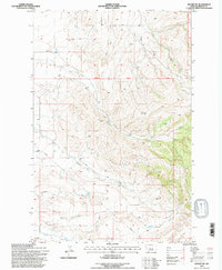
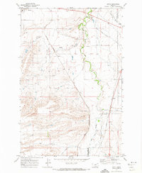
1995 Map of Moore SW
USGS Topo · Published 1997About this map
The small settlement of Garneill sits at the southwestern edge of this landscape, marking a transition between the open plains and the rising terrain of Fergus County. In the mid-1990s, when these revisions were finalized by the U.S. Forest Service, the area was defined by a network of drainage systems including Buffalo Creek and Meadow Creek. The mapping captures the intersection of industrial utility and natural landforms, shown through a prominent Pipeline corridor and an Electronic Site situated on high ground. Land use is further evidenced by several Gravel Pits scattered near the watercourses. The survey also precisely identifies the 3rd Standard Parallel North, a critical baseline for surveying in this part of Montana. From the summit of Horan to the meandering path of Dry Creek, the map provides a look at the rural infrastructure and ranching geography that characterizes this central Montana region.
Find a feature on this map
11 named features on this map. Tap any name to fly to it.
Don’t see what you’re looking for? This feature index may not catch every label — zoom into the map to look around manually.
Map Details
Editions of this 1995 Moore SW Map
This is the sole edition of this map. No revisions or reprints were ever made.
Other maps of this area

1889 · Big Snowy Mountain
USGS Topo · 1:250,000

1893 · Big Snowy Mountain
USGS Topo · 1:250,000

1954 · Roundup
USGS Topo · 1:250,000

1958 · Roundup
USGS Topo · 1:250,000
1970 · Buffalo
USGS Topo · 1:24,000

1970 · Crystal Lake
USGS Topo · 1:24,000

1970 · Moore
USGS Topo · 1:24,000
1970 · West Fork Beaver Creek
USGS Topo · 1:24,000
1970 · Moore SW
USGS Topo · 1:24,000
1970 · Sipple
USGS Topo · 1:24,000