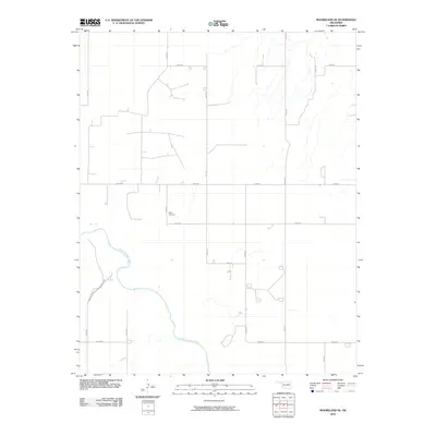
2010 Map of Mooreland SE
USGS Topo · Published 2010About this map
The North Canadian River winds through this section of Woodward County, Oklahoma, defining the low-lying hydrology of an otherwise structured agricultural landscape. The map reveals a precise section-line road grid typical of the Great Plains, with routes like N2200 Rd and E0490 Rd providing the primary framework for movement between rural homesteads. A significant local landmark for genealogists and family historians is the Miller Cemetery, located centrally near the intersection of several local roads. This survey, based on 2008 imagery, documents the sparse settlement patterns and drainage systems of the region at the start of the 21st century.
Find a feature on this map
15 named features on this map. Tap any name to fly to it.
Don’t see what you’re looking for? This feature index may not catch every label — zoom into the map to look around manually.
Map Details
Editions of this 2010 Mooreland SE Map
This is the sole edition of this map. No revisions or reprints were ever made.
Other maps of this area

1955 · Woodward
USGS Topo · 1:250,000

1958 · Woodward
USGS Topo · 1:250,000

1969 · Mooreland SE
USGS Topo · 1:24,000

1969 · Belva
USGS Topo · 1:24,000

1969 · Quinlan
USGS Topo · 1:24,000

1969 · Mooreland
USGS Topo · 1:24,000

1969 · Cedardale
USGS Topo · 1:24,000

1969 · Mooreland SW
USGS Topo · 1:24,000

1969 · Mutual
USGS Topo · 1:24,000

1969 · Mutual NE
USGS Topo · 1:24,000