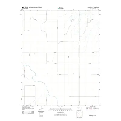
2012 Map of Mooreland SE
USGS Topo · Published 2012About this map
The N Canadian River snakes across this Woodward County landscape, carving a meandering path through the Oklahoma prairie south of Mooreland. This region is defined by the rigid geometry of the Section Line Road system, where a network of gravel and local routes like E0450 Rd and N2200 Rd divide the land into tidy agricultural blocks. For those researching local family history, the Miller Cem is a primary landmark, serving as a quiet anchor for the surrounding rural community. The map reflects a landscape of dispersed farmsteads and agricultural industry, where the natural hydrology of the river basin contrasts with the precision of modern land division. This 2012 survey captures the area’s enduring character as a sparsely populated ranching and farming corridor in the northwestern part of the state.
Find a feature on this map
19 named features on this map. Tap any name to fly to it.
Don’t see what you’re looking for? This feature index may not catch every label — zoom into the map to look around manually.
Map Details
Editions of this 2012 Mooreland SE Map
This is the sole edition of this map. No revisions or reprints were ever made.
Other maps of this area

1955 · Woodward
USGS Topo · 1:250,000

1958 · Woodward
USGS Topo · 1:250,000

1969 · Mooreland SE
USGS Topo · 1:24,000

1969 · Belva
USGS Topo · 1:24,000

1969 · Quinlan
USGS Topo · 1:24,000

1969 · Mooreland
USGS Topo · 1:24,000

1969 · Cedardale
USGS Topo · 1:24,000

1969 · Mooreland SW
USGS Topo · 1:24,000

1969 · Mutual
USGS Topo · 1:24,000

1969 · Mutual NE
USGS Topo · 1:24,000