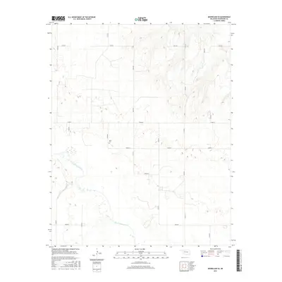
2016 Map of Mooreland SE
USGS Topo · Published 2016About this map
The North Canadian River meanders across the southwestern corner of this Woodward County landscape, defining the local hydrology amidst a structured grid of rural section-line roads. This 2016 survey illustrates the persistent agricultural and ranching layout of the region, where the terrain is dominated by the geometric precision of routes like E0450 Rd and N2210 Rd. For those researching local family history, the Miller Cem sits as a solitary landmark of the area's early settlement, positioned near the junction of N2200 Rd and E0490 Rd. The map provides a clear look at the intersection of modern cartographic standards and the traditional Oklahoma plains landscape, capturing the subtle elevation changes and drainage patterns that feed into the river valley.
Find a feature on this map
16 named features on this map. Tap any name to fly to it.
Don’t see what you’re looking for? This feature index may not catch every label — zoom into the map to look around manually.
Map Details
Editions of this 2016 Mooreland SE Map
This is the sole edition of this map. No revisions or reprints were ever made.
Other maps of this area

1955 · Woodward
USGS Topo · 1:250,000

1958 · Woodward
USGS Topo · 1:250,000

1969 · Mooreland SE
USGS Topo · 1:24,000

1969 · Belva
USGS Topo · 1:24,000

1969 · Quinlan
USGS Topo · 1:24,000

1969 · Mooreland
USGS Topo · 1:24,000

1969 · Cedardale
USGS Topo · 1:24,000

1969 · Mooreland SW
USGS Topo · 1:24,000

1969 · Mutual
USGS Topo · 1:24,000

1969 · Mutual NE
USGS Topo · 1:24,000